I live in a relatively short street, Tudor Street, Dulwich. It runs from Kitchener Street (formerly Brunswick Avenue) and Fullarton Road and it has 21 allotments I decided to write a history of my street and, The History of Tudor Street Dulwich (formerly Victoria Park), was the result. The History traces the history of each allotment from 1839, when the land was first granted shortly after colonisation, up until the late 20th century, giving the names of each owner and the dates when transfer took place. The History has two pages for each allotment and includes, a photo, or sketch of the house, and some biographical details of some of the owners or occupiers.
Most of the information can be easily found from the internet, using:
- SAILIS (South Australian Integrated Land Information System) website of Land Services SA, https://sailis.lssa.com.au/ for property records,
- TROVE, https://trove.nla.gov.au/ the National Library of Australia, digital collection of newspapers up to about 1953.
- State Library of South Australia, https://www.slsa.sa.gov.au/home can add further information.
- Sewerage Drainage Plans, https://maps.sa.gov.au/drainageplans/
All of this can be searched at no cost. My only cost involved was an early plan from SAILIS.
This is how to find out the land ownership of one property (allotment). It is then a simple matter to repeat the process of every other house in the street. It should be remembered that house numbers were developed to assist the postman deliver mail, property references use allotment numbers, based on the original sub-division.
The Certificate of Title (CT) reference number can be found on your Local Government rates notice. The first number is the volume number and the second the folio.
If you don’t know this number, the alternative is to go to the SAILIS website.
- Click on ‘Continue as a Guest’
- Click on ‘Land Search’, then ‘Property Search’
- click on ‘Address’
- fill in Street name and Suburb
- Click on search. This will bring up a list of all titles for the street and street numbers. You will find the street number you want. Copy down the CT number, e.g. 5020/714.
- Click on select for the address you are researching. ‘Order Confirmation – Property Search’ page will show. The CT number can be found on the top left/right-hand corner.
- Click on ‘Land Search’
- click on ‘Child-Parent Title Search’
- Select ‘Title’
- Insert the volume and folio number, press Enter. This will confirm the research request.
- Tick the acknowledgement box, press Enter.
- Click on ‘Confirm Order’. This will give you the parent title – copy down the CT number.
- Click on Parent-Title number, tick acknowledgement box and ‘Confirm Order’
- A PDF of the CT should appear automatically in your Download File. This is a printable copy which you need to save.
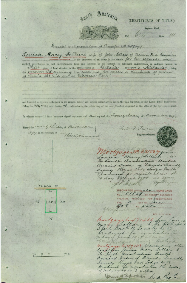
- Make a note of the CT number, under the coat of arms. This is your next search. I rename the file to show street number and CT reference, e.g. 23 Tudor_ TitleImage_CT_786_185.
- Repeat steps 12 to 14 until all you have is a ‘Memorandum of Transfer’ and no new CT number.
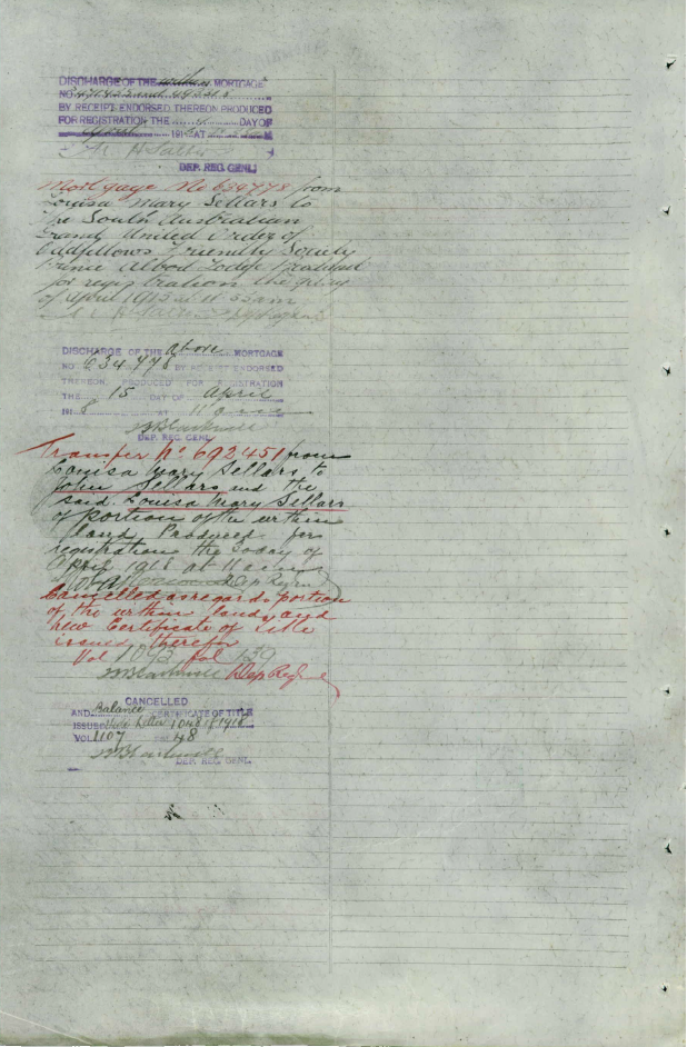
The CT give all the critical details of ‘who sold to who and when’. The reference number is at the top right-hand corner. There are then details of the owner’s name, residence and occupation and a description of the property and date. There is a small plan of the property. Then follows all the transactions relating to the land, such as mortgages, leases, caveats, and transfers. If the allotment is sub-divided or the page has no space left, a new title is created, and the new CT reference is given. You can travel forward or backwards from this title. Going backwards, by re-following the steps above.
With the earliest CT there will be a reference to a ‘Memorandum of Transfer’ (under the coat of arms) and a number (and no CT number). This is the reference to pre-Torrens Title records, and is only available to current owners (or with their permission)[i]. This ‘packet’ of documents will generally be for the period from 1839, or later, when the land was first sold, up until when it was brought under the Real Property Act in 1858, or thereafter. It is necessary to apply to Land Services SA (Level 9, 101 Grenfell Street, Adelaide) to view this packet. There are no photocopying facilities, so a camera is necessary to take copies. However, the wealth of information available is well worth it.
If you are doing a street history, you will need to follow these steps for each property. You may have a strata title in your address. I haven’t followed the history of each address, and only start before the strata property was built. Generally, you will end up with about half a dozen titles for each address. Details of ownership can then be extracted from each CT.
To put the property into context it is worth purchasing a copy of the File Plan, by going to ‘Image Search’ on the top tool bar, and then ‘Plan Image Search’. The File Plan number is given on the CT. There will be a small cost to obtain a copy of the File Plan. There may even be two Plans, the original plan when the area was subdivided, and a more recent plan.
Further information can be found regarding property.
Local government records.
Council annual assessment records provide information on not only the owner, but also the occupier, if the property is leased or rented, and any structure on the property, which is useful to date construction. Many local government libraries have microform copies of their early assessment records. Genealogy SA has microfiched a considerable number of local government assessment records and State Records SA, has many other assessment records. A listing of the available assessment records can be found in South Australian History Sources, Chapter 7.
Directories
South Australian Directories, were printed up until 1973 (sometimes called Sands & MacDougall Directories), provides details of occupancy, and sometimes occupation.
Drainage Sewerage Plans
https://maps.sa.gov.au/drainageplans/
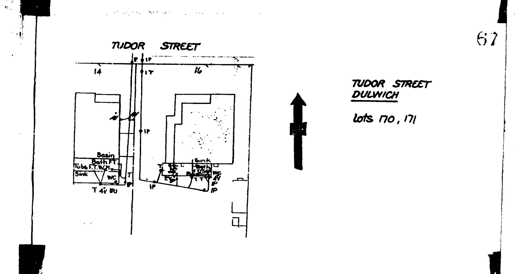
Open the site, Click on Enter, type in address (Suburbs, followed the street number and name) in Search box. This will bring up a map of the street showing the sewerage connections. Click on the ‘green spot’, which will bring up a box. Click on ‘What’s Here?’ and then Click on ‘Find drainage plan for this property’ and then download the plan. This plan gives you some idea of the floor plan of the property, particularly interest for property which have had more recent renovations.
Newspapers
TROVE, the National Library portal provides access to its huge digitized newspaper collection, up to about 1953. You can search on the street name, or individuals, to find out biographical information. For instance, I discovered that two residents of Tudor Street, died of the Spanish Influenza in 1919.
The Internet
The internet (try typing in the street address). Often you can find details of earlier sales of a property, photographs and floor plans.
Using a combination of these resources will provide information on ownership, occupation and provide some guidance as to when house was first built.
References
Peake, Andrew G, The History of Tudor Street Dulwich (formerly Victoria Park), 2021
South Australian History Sources, 2019
Sladek, Ruth, The History of Dudley Street, Parkside South, December, 2020
[i] The Minister of Planning has notified the author, that following representation, there will be an amendment to the Real Property Act, allowing access to these ‘packets’ after 80 years.


